The History of Salt Marshes
Located in South Brittany, the Guérande salt thousand-year-old tradition is perpetuated.
Extending over a surface of 1,720 hectares, the Guérande history of salt marshes constitute a priceless regional heritage. More than a thousand years of history are preserved in this site, which has been maintained by generations of salt workers (“paludiers”). The marshes are one of the few areas along the coast which have been preserved from industrial activities. They produce a natural product in a traditional way: sea salt. They are also a preservation area for marsh flora and fauna.
The Guérande salt basin covers the towns of Batz sur Mer, Guérande and La Turballe (Le Pouliguen, Le Croisic and La Baule have filled theirs in). These territories are zones which are protected by numerous regulations, and, since 1996, have been classified ‘a remarkable world heritage site’.
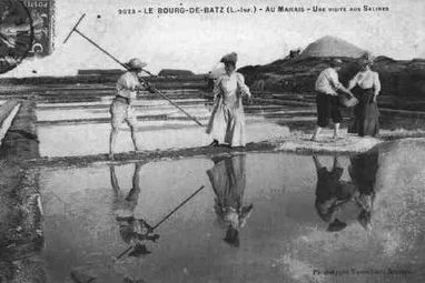
They are the northernmost salt marshes being cultivated in Europe, and although they benefit from a special micro climate, the harvesting season is very short. This necessitates a daily harvest directly on the clay beds. In regions with a more favourable climate, the harvest is less frequent, and carried out salt on salt (often every two days in Noirmoutier and the Island of Ré). However, this feature is also the reason for our salt’s quality.
The current production technique in the salt marshes, known as the solar technique, was already in use before the 9th century. The creation of salt works took place over several centuries, and some works from the Carolingian era (751 to 10th century) are still being used intact in Batz sur Mer. Around 1500, the salt marshes made up 80% of their current surface area. Between 1560 and 1660, thanks to the development of sea trade, 2,500 crystallisation ponds or “oeillets” were built. The last salt works were built around 1800. At its peak, the basin contained 22,000 “oeillets”.


More than 1000 years of history
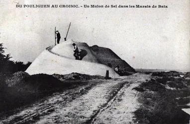
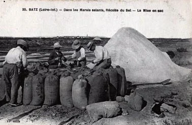
The marshes have always known cycles of prosperity and decline, due to series of bad or excellent harvests, disastrous storms or demand problems. As there were limited means of storage, surpluses were stored in a simple layer of earth until the middle of the 20th century.
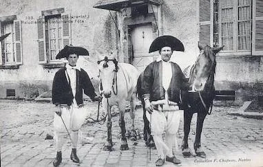
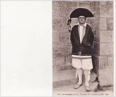
The true historical centre of salt “from Guérande” has always been Batz and its villages, Kervalet, Trégaté and Kermoisan, where it has been almost the unique activity for a thousand years. Trading activities were also predominant, thanks to the presence of the sea for transport via the ports of Croisic and Pouliguen, before the creation of the railway (initially used for transporting salt), then road transport.
20th century
At the beginning of the 20th century, the French salt market was still regional, with each region using its own local production method. Guérande salt supplied the west of France through numerous traders working directly with the producers.